
Summary of Vehicle Tracking System Based on GPS and GSM
This article describes an Arduino-based vehicle tracking system utilizing GPS and GSM modules. It enables users to locate stolen vehicles by sending an SMS command, receiving real-time latitude and longitude coordinates on a mobile phone and an LCD display. The system is designed for installation in cars, boats, or motorbikes, offering benefits like delivery status monitoring and driver supervision.
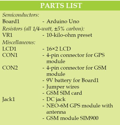
Parts used in the Vehicle Tracking System:
- Arduino Uno board
- 16×2 LCD
- GPS module
- GSM module
- Potmeter (VR1)
- SIM card
- PC with Arduino IDE

Presented here is an Arduino-based vehicle tracking system using global positioning system (GPS) and global system for mobile communication (GSM) modules. GSM modem with a SIM card used here uses the communication technique of a regular cellphone. The system can be installed or hidden in your vehicle at a suitable location. After installing this circuit, you can easily track your stolen vehicle using a mobile phone. The author’s prototype is shown in Fig. 1.
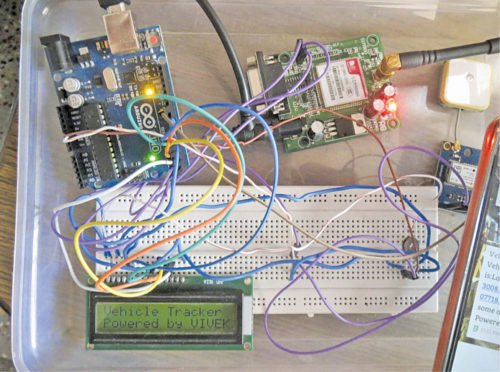
Author’s prototype
Circuit and working
Circuit diagram of the GPS- and GSM-based vehicle tracking system is shown in Fig. 2. It is built around Arduino Uno board (BOARD1), 16×2 LCD (LCD1), GPS module, GSM module and a potmeter (VR1). Working of the circuit is very simple. To operate the circuit, you need to follow the steps given below:
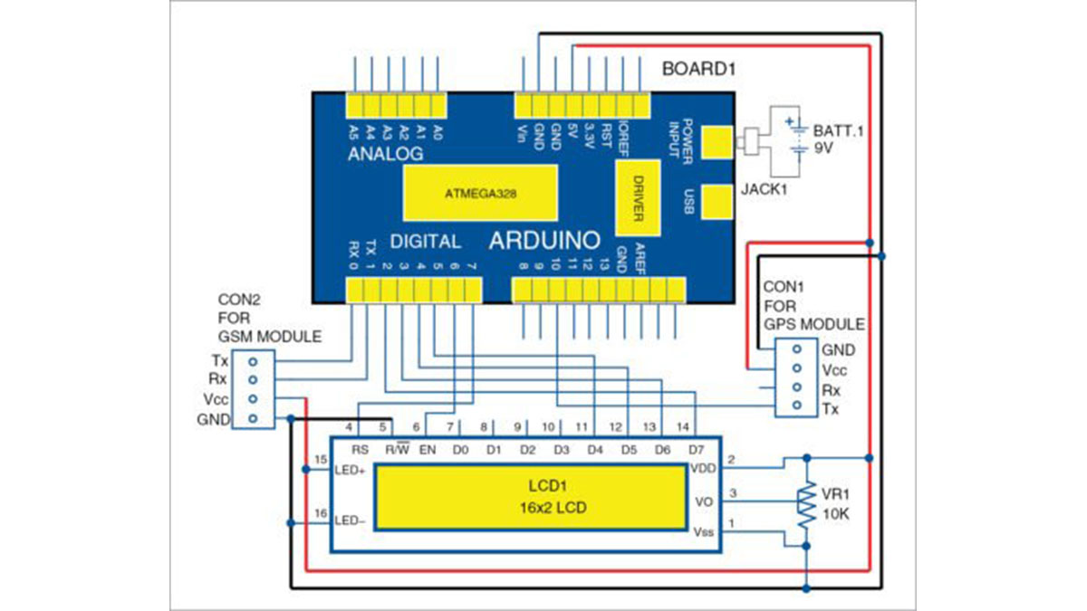
Circuit diagram of GPS- and GSM-based vehicle tracking system
1. First, install Arduino IDE 1.8.3 in your PC. Add GPRS_Shield_Arduino’s header file into the library of Arduino IDE. Download the file from the link.
2. Include or add the user’s mobile number (on which you want to receive the GPS location messages) in the source code (vehicle_code.ino). Compile and upload the code onto the Arduino board using Arduino IDE
3. Once the code is burnt, make connections as shown in the circuit diagram.
4. Insert a valid SIM card in the GSM module connected with the Arduino board. Make sure that this SIM has necessary balance to send alert messages to the user’s mobile phone.
Construction and testing
An actual-size PCB layout of GPS- and GSM-based vehicle tracking system is shown in Fig. 3 and its components layout in Fig. 4.
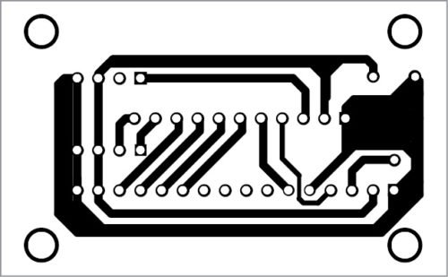
PCB layout of GPS- and GSM-based vehicle tracking system
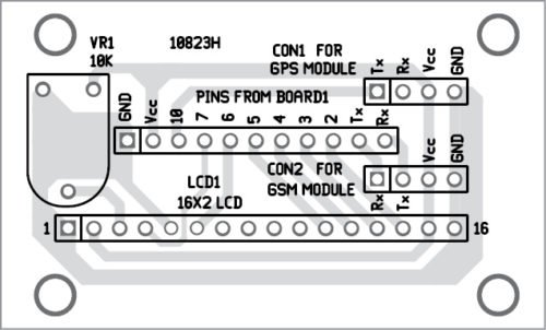
Components layout for the PCB
Once you are done with connections and uploading of the code, place the system (Arduino, LCD, GPS and GSM with SIM card) in the vehicle. Now it’s time to track the SIM card inserted in the GSM module. To track the SIM card, send an SMS to the mobile number of the SIM card by typing “Track Vehicle” from your (user) mobile phone.
After sending the message, wait for a few seconds until you receive location detail of the SIM card in the form of latitude and longitude values on LCD1 as well as in your mobile phone. Vary preset VR1 till you get clear visible text on the LCD1. After getting the latitude and longitude position (in decimal format), convert the first four digits of these values into degrees and minutes like 28°38’ and 77°13’. Enter these values in the search box of Google Maps and then click “Search” button to find the exact location.
Applications
The system can be used by individual vehicle owners as well as organisations to locate and track their vehicles. Organisations can use it to track the status of their product delivery by trucks at all times. It also helps owners to keep tab on their driver, preventing vehicle abuse and thus resulting in significant cost-savings. The system can be easily installed in any vehicle such as cars, boats and motorbikes.
Read More Detail :Vehicle Tracking System Based on GPS and GSM
-
How do I install the software required for this project?
You must install Arduino IDE 1.8.3 on your PC and add the GPRS_Shield_Arduino header file into the library. -
What command should I send via SMS to track the vehicle?
You need to send an SMS to the SIM card's mobile number typing exactly Track Vehicle. -
Where can I see the location details after sending the SMS?
The location details appear as latitude and longitude values on the 16×2 LCD and are sent to your user mobile phone. -
How do I find the exact location using the received data?
Convert the first four digits of the decimal latitude and longitude into degrees and minutes, then enter them into Google Maps. -
Can this system be installed in different types of vehicles?
Yes, the system can be easily installed in any vehicle such as cars, boats, and motorbikes. -
What preparation is needed for the SIM card before use?
You must insert a valid SIM card that has necessary balance to send alert messages to the user's mobile phone. -
Why might the text on the LCD not be visible clearly?
You should vary the preset VR1 until you get clear visible text on the LCD1. -
How can organizations benefit from this tracking system?
Organizations can use it to track product delivery status by trucks at all times and prevent vehicle abuse by drivers.
